


Minneapolis Cycling Map app for iPhone and iPad
Developer: Zuzana Hunadyova
First release : 24 Nov 2015
App size: 3.13 Mb
Forbes identified Minneapolis the worlds fifth cleanest city in 2007, citing the citys bicycle lanes, buses and LRT (Light Rail Train).
Minneapolis has 54 km of dedicated bike lanes on city streets and encourages cycling by equipping transit buses with bike racks and by providing online bicycle maps. Many of these trails and bridges, such as the Stone Arch Bridge, were former railroad lines that have now been converted for bicycles and pedestrians.
The Public Works Department expanded the bicycle trail system from the Grand Rounds to 90 km of off-street commuter trails including the Midtown Greenway, the Light Rail Trail, Kenilworth Trail, Cedar Lake Trail and the West River Parkway Trail along the Mississippi.
Minneapolis ranks 27th in the nation for the highest percentage of commuters by bicycle, and was editorialized as the top bicycling city in "Bicyclings Top 50" ranking in 2010.
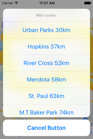
In case you want to explore any of the urban or outside city bicycle trails, this application will help you to choose one appropriate for you. Plus it will provide you other additional services, list of them you can read below.
In this application you will find:
• current and complete cycle ways
• maps and routes
• advice for new riders
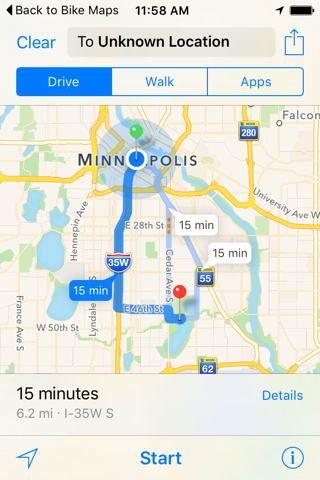
• showing cycle route locations
• showing users location
• tips for riding safely
• sharing map location and information
• sharing map routes